Lot of SFers are recreational walkers and I’m sure many take photos, so thought it would be interesting to see the different terrains of people’s randos. There must be a lot of variety and it would be great to see other people’s local landscapes
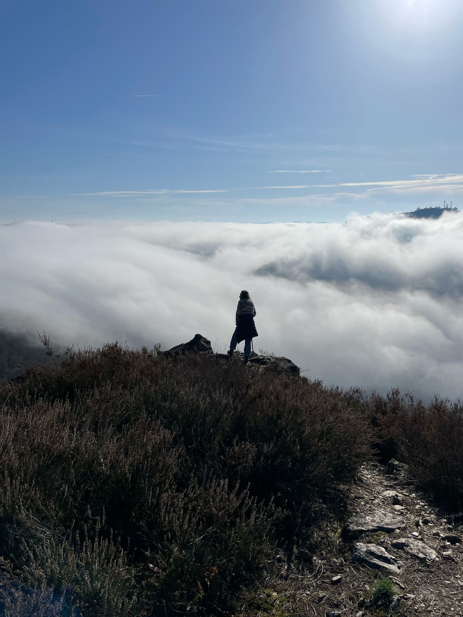
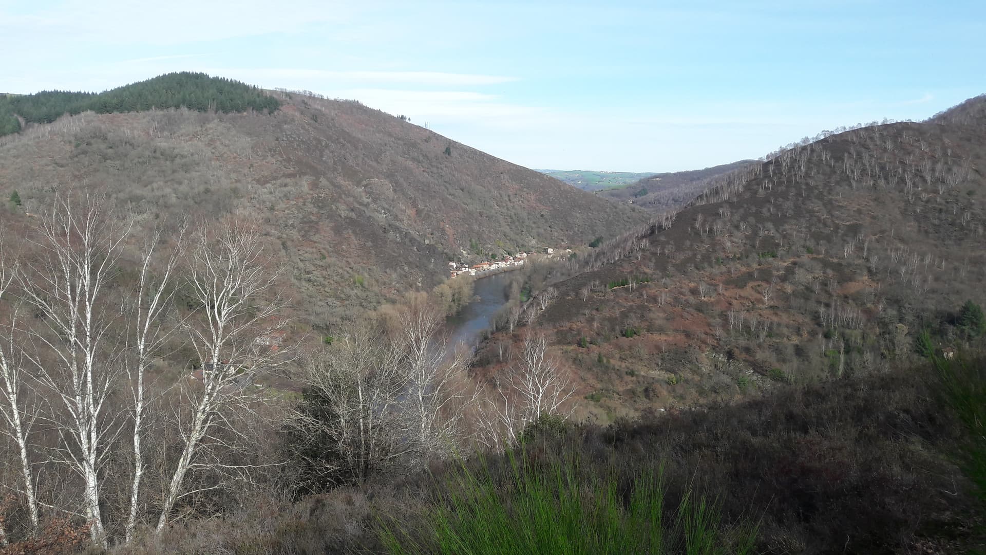
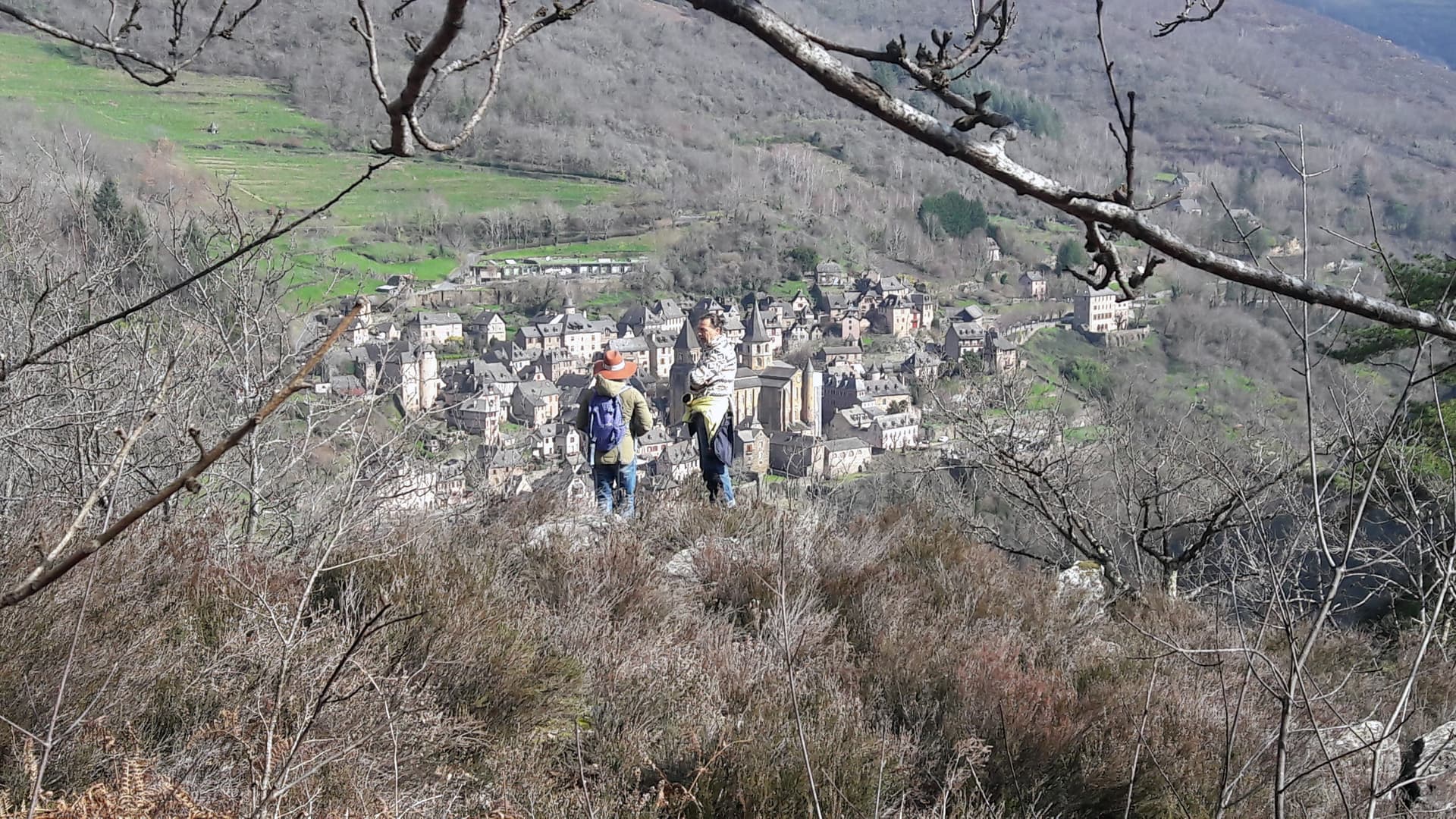
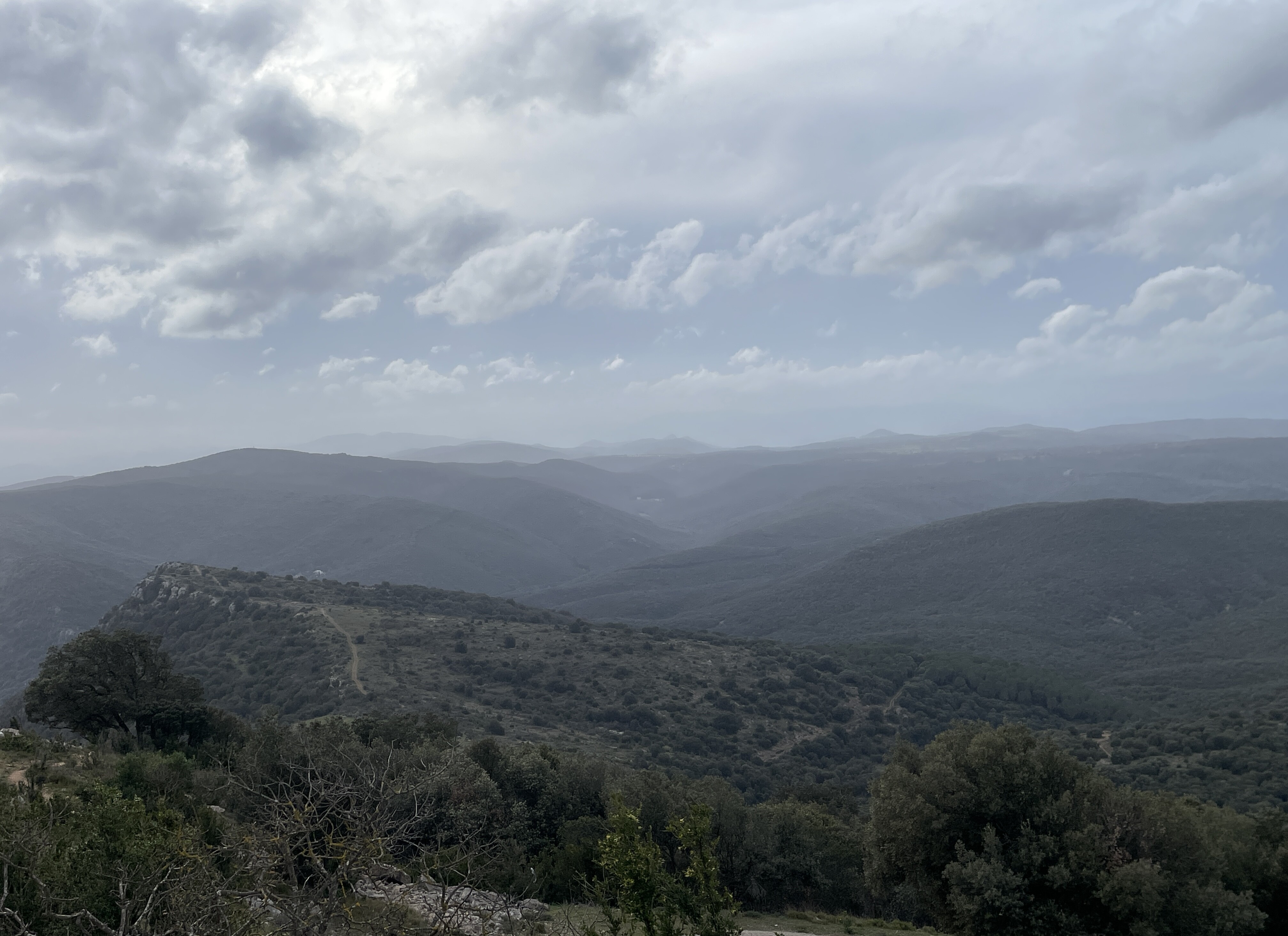
We usually walk on Weds with our group and alone on Sundays. Weds walks are very varied, whereas Sundays we do a very local walk, which usually means climbing out of the Lot Valley, walking along the ‘top’ and back down again by a different route. On both days we usually just do 10-12 kms but that includes 500m ascents/descents usually on rough terrain. But today we did 12kms and 2x500m ascents in the hills around Conques (and this evening my knees are very aware of their day’s work).
Nice idea Mark, I’ll have to find some pics. 12km with 1000m ascent & descent is pretty good going though, and IIRC you’re somewhat more mature than I am - not at all sure my knees could manage that any more, nor my wife.
Thanks, I’m seventy-one, but a former member of our walking group celebrated his seventieth birthday by walking from Conques to Santiago de Compostella. We walked with him for the first day, but had day packs and he was carrying around 50kgs. Nevertheless, he did it in 35 days. Ex-Dutch Air force - yes - I too didn’t know they had one, or maybe they just walk everywhere!
Incidentally, he lost nearly 20 kgs of bodyweight - came back a skeleton. If my wife lost that much , there might just be one arm left!
Great pics and great idea In the hiking group I joined I’m always amazed at what some folks in their 70’s achieve. I’m a very firm believer in excercise and all the benefits, having directly seen how it greatly helps mobility and well being as we all get older
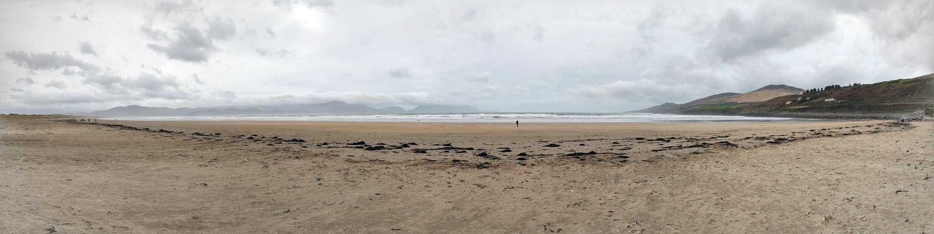
On a bleak February day, we walked along Inch Strand, a sand spit attached to the Dingle Peninsula, County Kerry. It is surprisingly longer (6km) than it looks when you first step onto it.
A friend of ours here started his walk from Canterbury to Rome on his 70th birthday. Didn’t actually make it through the pilgrim’s door at the Vatican until he was 72 tho’. On his first leg he had to divert home (jura) after 750km with achilles tendon problems that took a year to heal. But he made it! Maybe because his pack was at most 10kg.
We are/were walkers and am very much hoping to get back to it after over a year of flat granny walks, due to health of our walking companions and mine. At the moment dog is hard done by and OH does all the walks, but sun is shining so going to have a short walk this afternoon to test out the enhanced feet.
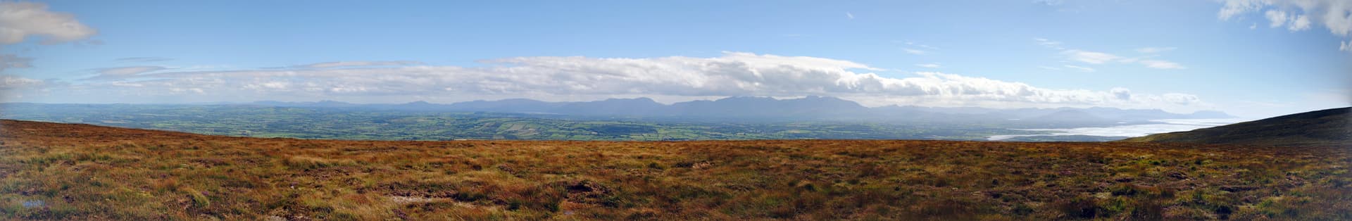
Taken in August last year - the view from the top of a lower summit in the Slieve Mish range, just outside of Tralee, County Kerry, looking south towards the Ring of Kerry, Lake Killarney, Carrauntoohill, and over Dingle Bay. Inch Strand can be seen on the right hand side, just sticking out into the bay. The views on both sides of the Dingle Peninsula on that day (other side, right of frame, looks down onto Tralee Bay) were fantastic!
Have loved the West coast for nearly sixty years in different decades and in different ways and places, firstly as a tourist, later as an artist and researcher. Probably won’t experience it again, but have loved those landscapes and the rich depth of the culture.
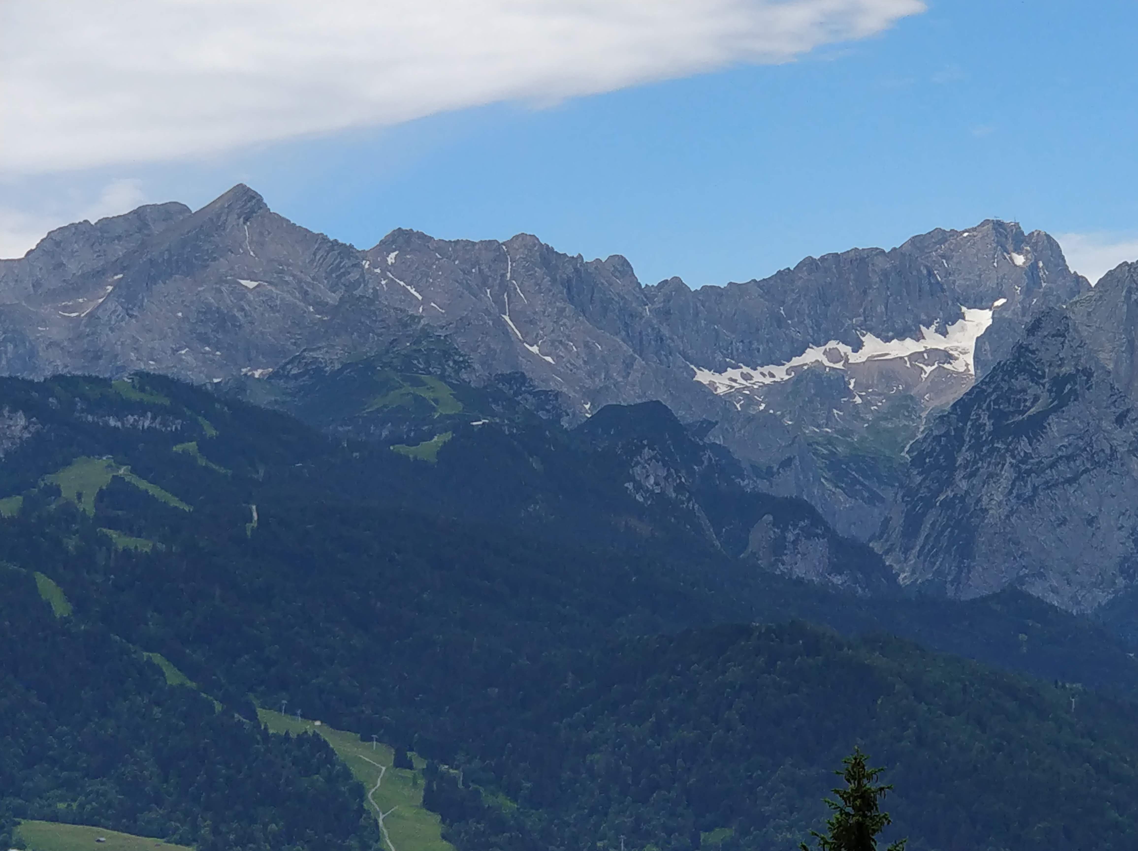
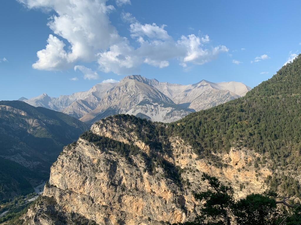
Again, not from France, this time from the Bavarian Alps, near Garmisch-Partenkirchen, a picture of the north face of the Alpspitze on the left (pyramid shape) and the Jubiläumsgrat (ridge extending rightwards from Alpsitze) leading to the Zugspitze on the right hand side. Taken from the ascent path up to a summit across the valley, whose name would probably get me banned by the content filter, and which doesn’t sound like wink.
Promise, I’ll find some photos of places near to me in due course, but I “get about a bit” as they say.
Such great photos! Managed totally un-photogenic 4km/walks this week, so a way to go yet.
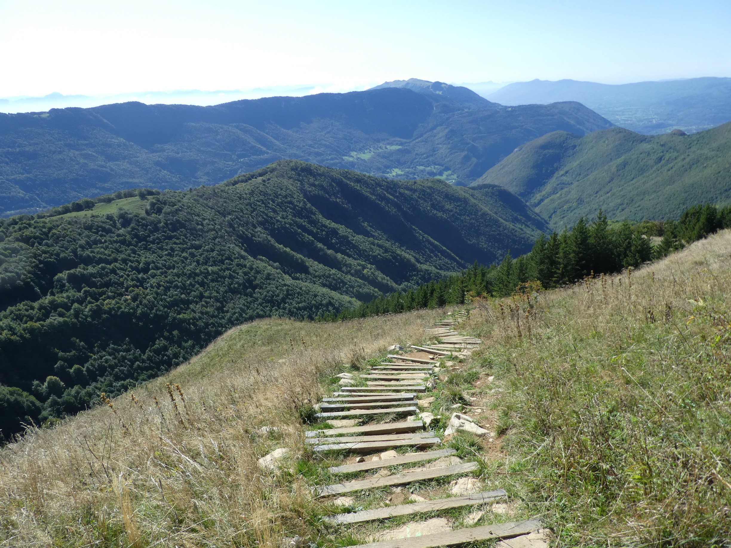
Instead a photo of the last significant walk with our late walking friend - crêt de chalam at 1500m. Not bad with stage IV cancer as actual amount climbed was about 500m
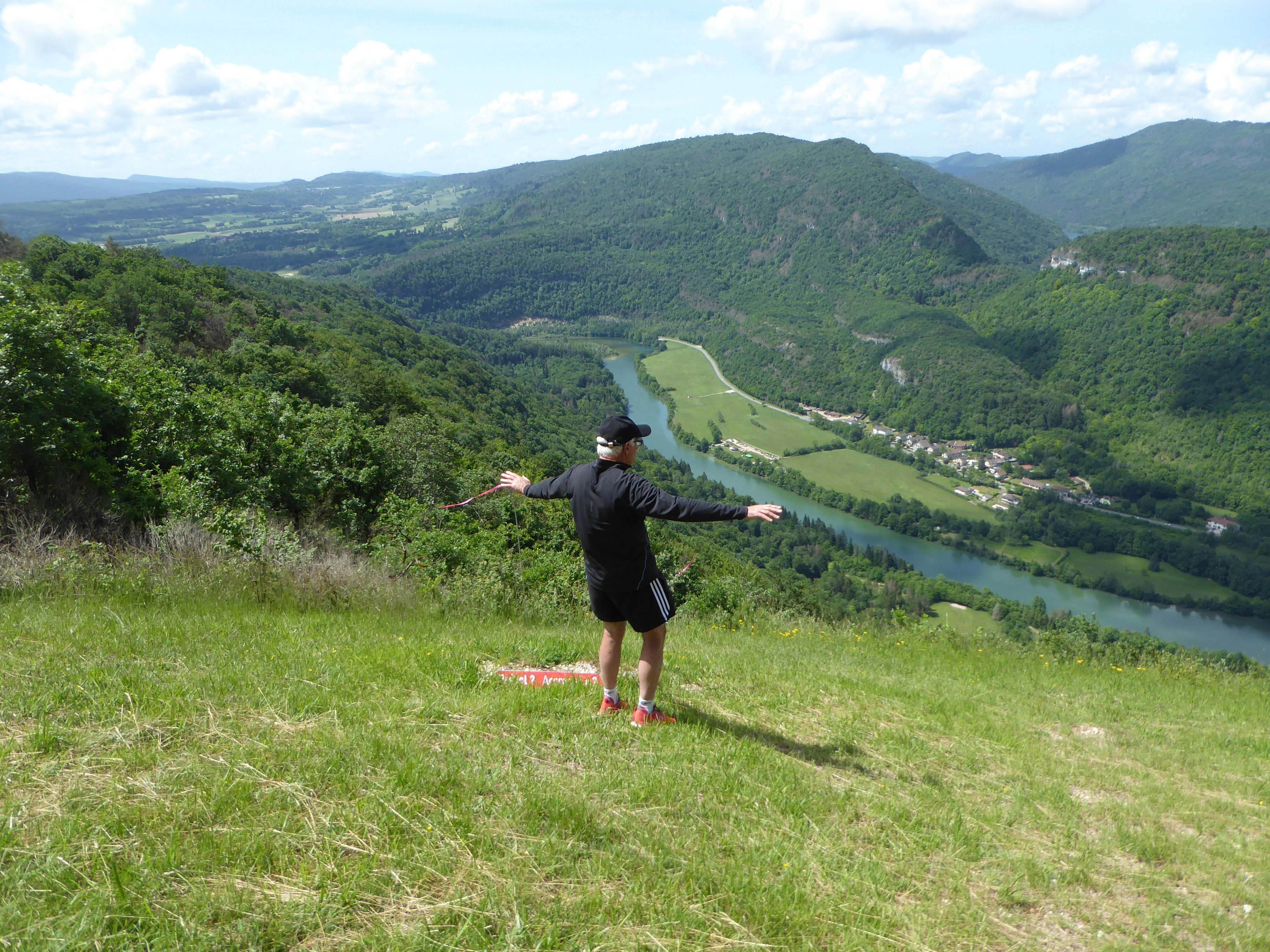
And her also now late husband, just pre-diagnosis, on a walk above the Bienne/Ain.
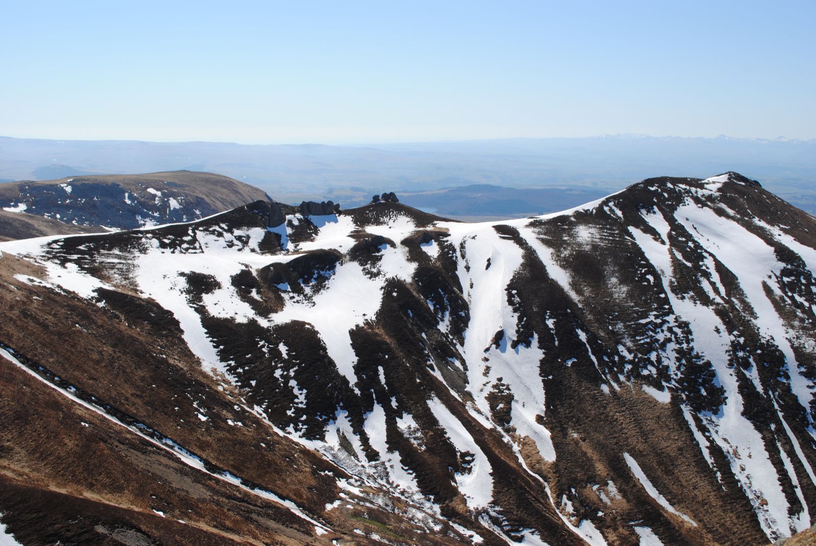
Looking south over the Puy Gros from the Col de la Cabane in the Sancy national park, Massif Central. The mountains to the right in the far distance form part of the Monts du Cantal range. This was taken in 2011 at the beginning of April.
Firmly tongue in cheek, about 14 km that day, from the Col de la Croix St. Robert to the top of the Puy de Sancy, and back by the same route across the summit ridges. Can’t remember what we had for sandwiches, but I did lose my Nikon camera lens cover somewhere en route